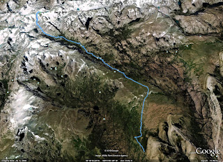
Mt. Marcy (we hiked up it again later when we had a GPS)
GPX file

Guadalupe Peak (this one is just a trail so pretty easy)
GPX file

Wheeler Peak (New Mexico) - This one has a "trail" from the lake to ridge, but it is less obvious.
GPX file

Humphreys Peak (Arizona)
GPX file

Mt Whitney (no GPS track sorry I used the batteries in my camera)
Since we hiked up the trail (except above the camp) there isn't much to see here anyway.
Boundary Peak (I am not 100% sure that is the way everyone goes, but it works)
GPX file

Kings Peak (Utah) Not much that is tricky besides a part near gunsight notch
GPX file
 |  |
Black Mesa (Oklahoma) nothing tricky at all
GPX file

The next highpoints were all easy and don't have GPS tracks. Britton Hill (Florida), Cheaha (Alabama), Brasstown Bald (Georgia), Mt. Mitchell (North Carolina), Woodall (Mississippi), Mount Magazine (Arkansas), Driskill Mountain (Louisiana), or Mount Davis (Pennsylvania)
Backbone Mountain (Maryland) It can be confusing if you do it at night like we did.
GPX file
No GPS track for Spruce Knob (West Virginia), Cambell Hill (Ohio), Hoosier High Point (Indiana), Taum Sauk (Missouri), Panorama Point (Nebraska) and none is needed.
Gannett Peak (Wyoming) from the east side, and a failure
From the northwest side and a success.
GPX file failed attempt
GPX file successful attempt done at a later date.
Black Mountain (Kentucky) No GPS track is needed either, but there is one anyway
GPX file
Mount Rogers (Virginia) it is a wilderness area, or so they say.
GPX file
No GPS tracks for Ebright Azimuth (Deleware), High Point (New Jersey), Clingmans Dome (Tennessee), Sassafras Mountain (South Carolina)
Mount Mansfield (Vermont) no need for a gps track, but here one is.
GPX file
Mount Washington (New Hampshire)
GPX file
Mount Katahdin (Maine)
GPX file
No GPS track Jerimoth Hill (Rhode Island)
Mount Frisell (Connecticut)
GPX file
No GPS track Mount Greylock (Massachusetts)
Mount Elbert (Colorado)
GPX file


No comments:
Post a Comment